
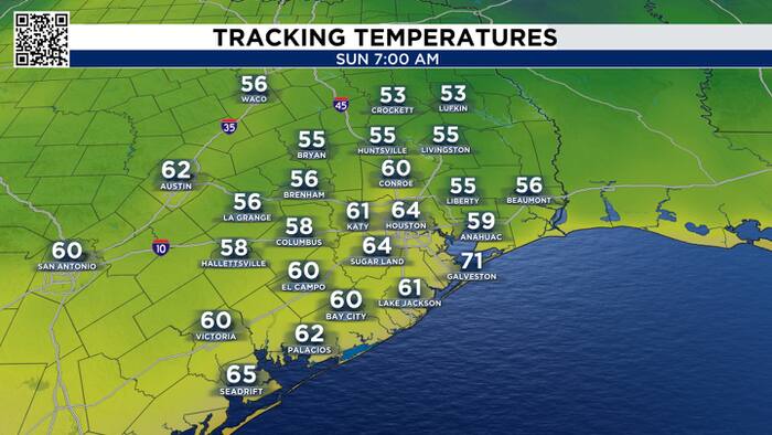
Humidity and moisture continue to stream in. Isolated showers early could become isolated thunderstorms as we head into the late afternoon hours. Brief heavy downpours and active lightning are all in play. Expect the humidity to peak around midday through evening. It will feel yucky, albeit the actual air temperatures might not look all that bad.

Early Week:
After a refreshing weekend, moisture returns to Houston as an onshore wind returns. This will boost humidity and bring low-end rain chances along the Gulf breeze.

Daily rain chances will be on board for the afternoon hours as plenty of moisture streams in from the coast.

Late Week:
While this week will feel like summer, I’m watching for our next chance of fall-like conditions. A cold front is forecast to reach southeast Texas on Friday, and by the weekend, temperatures could be 10 degrees cooler, dropping Houston into the low 80s!


Next week the humid onshore flow returns, increasing sea breeze shower chances. Next weekend there is a chance for a cool down but it will depend on if a front reaches southeast Texas.


